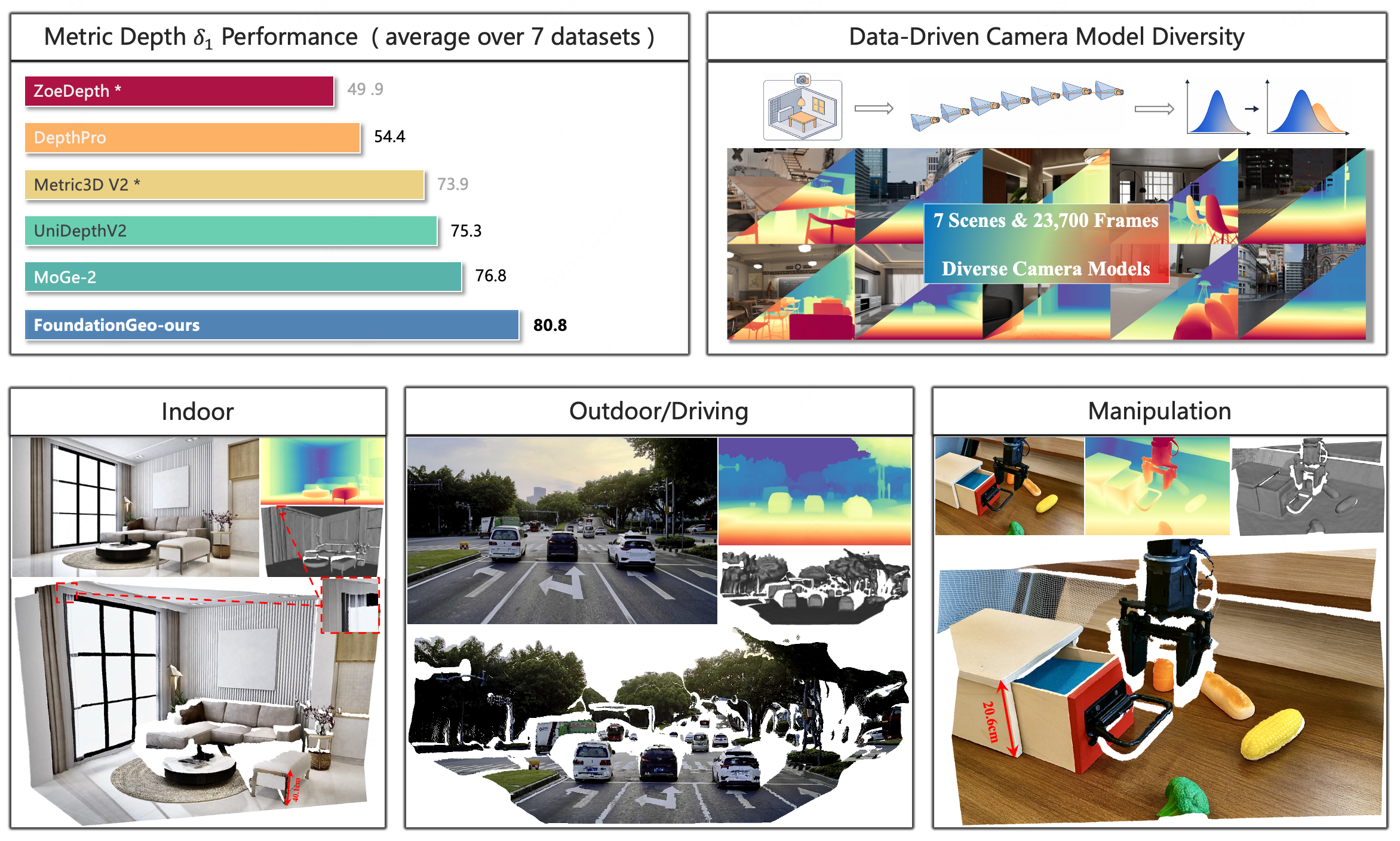
We present FoundationGeo, a two-stage framework that explicitly bridges relative and metric prediction via spatial calibration and principled data design. Stage 1 learns a high-fidelity, affine-invariant geometry model by initializing with DINOv3 and training on a curated 10.2M-sample multi-domain corpus with complementary local-detail supervision, yielding sharp boundaries and strong cross-domain generalization. Stage 2 moves beyond global scaling by introducing lightweight pixel-wise calibration fields for metric estimation: a scale field for spatially varying metric alignment and a ray-direction correction field that mitigates directional bias in point-map geometry, together producing metrically consistent 3D point maps. Beyond model design, we identify camera intrinsic coverage, especially focal length distribution mismatch between training and test data, as a key bottleneck for zero-shot metric generalization: performance drops sharply when test intrinsics fall outside the training distribution. To address this, we synthesize additional training data across diverse focal lengths using a Blender-based data engine, repairing under-covered focal regimes and improving robustness under intrinsic shift. Extensive zero-shot evaluations across seven benchmarks show that FoundationGeo significantly strengthens cross-domain robustness, staying near the top across diverse domains while avoiding the sharp cross-domain performance drops observed in other methods. This consistency translates into the best overall performance, surpassing heavier baselines by over 5.2% on average.
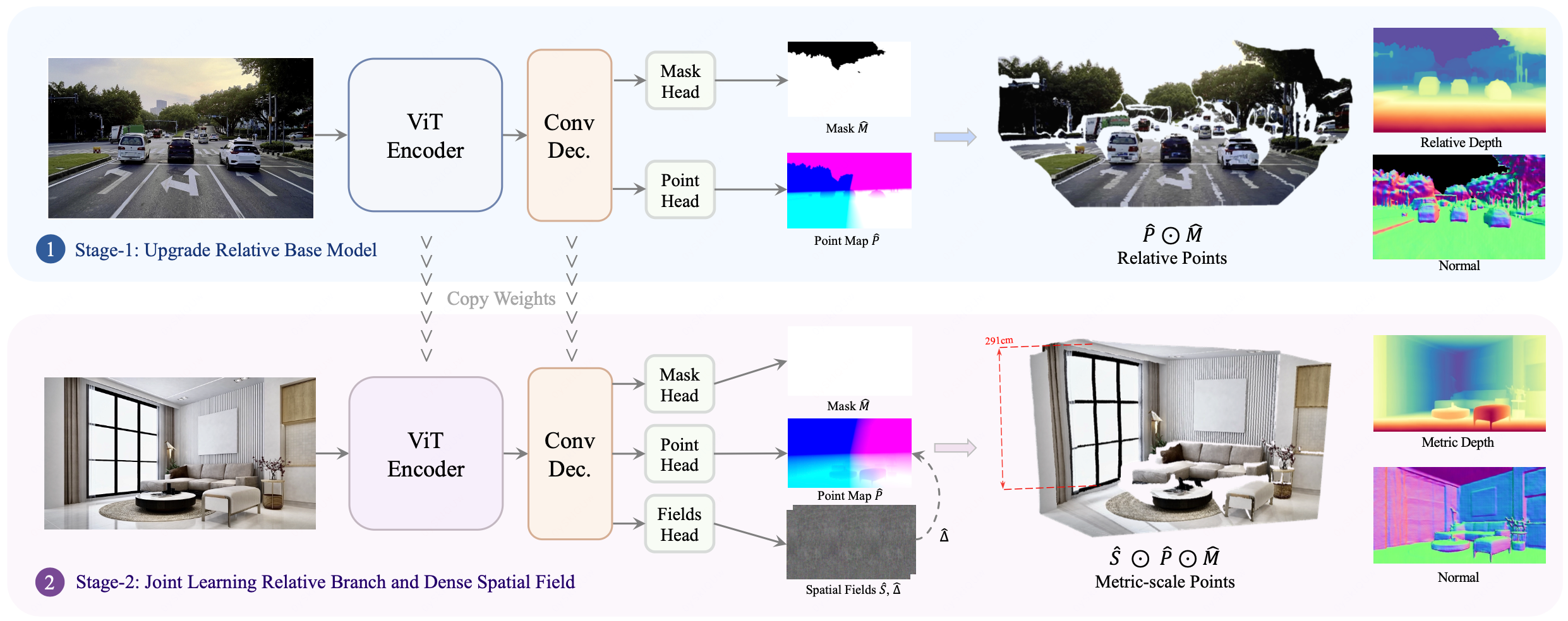
FoundationGeo architecture. A ViT encoder with a lightweight up-sampling convolutional decoder first learns a high-fidelity relative geometry branch, predicting a validity mask M̂ and an affine-invariant point map P̂. In the second stage, we first apply a ray-direction correction field Δ̂ to P̂ to obtain a direction-refined relative point map, and then use a spatial scale field Ŝ to perform spatially varying rescaling, producing a metric point map P̃. Metric depth and surface normals are subsequently derived from P̃.

Indoor
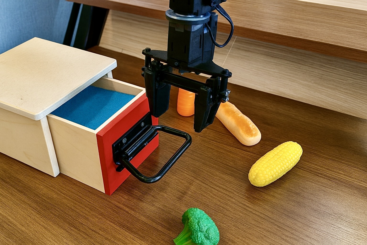
Robotic

Object

Driving
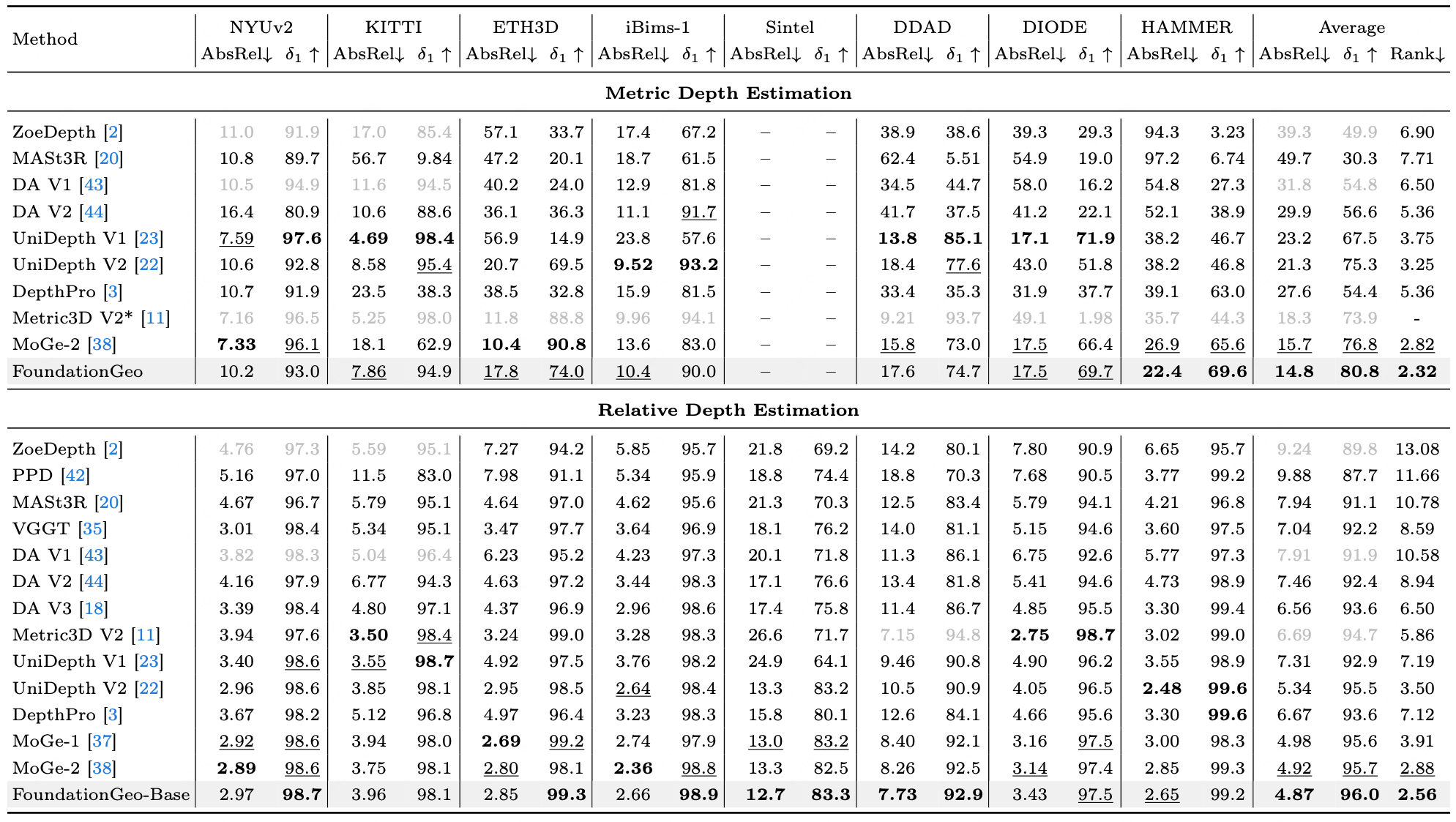
Quantitative results for metric and relative depth estimation. AbsRel and δ1 are in percentage. The best values are highlighted in bold, and the second-best ones are underlined. * means model needs GT intrinsic as input. Gray numbers denote models trained on respective benchmarks or need GT intrinsics, thus excluded from ranking.
@inproceedings{liu2026foundationgeo,
  title={FoundationGeo: Learning Spatial Pixel-Wise Fields for Monocular Metric Geometry},
  author={Liu, Muxin and Lyu, Xiaoyang and Ren, Tianhe and Dai, Peng and Wu, Xiaoshan and Zhang, Zhiyue and Zhang, Jiaqi and Lin, Jiehong and Shi, Shaoshuai and Qi, Xiaojuan},
  booktitle={European Conference on Computer Vision},
  pages={353--371},
  year={2026},
  organization={Springer}
}